More trouble for #SouthernFail. They should lose their franchise forthwith, either being run direct by the government or being put under the umbrella of TFL…
Plans by an under-fire rail company to change the way it staffs its trains will lead to “unacceptable” and repeated breaches of the Equality Act by denying disabled passengers the support they need to travel, it has been claimed. Southern – which operates train services across parts of south London and southern England – is planning to replace conductors with “on board supervisors” (OBSs), whose job will not include stepping onto the platform at stations. Campaigners fear that introducing these supervisors will mean that disabled passengers who need assistance on platforms at unstaffed stations could be left stranded and unable to board their train. Southern is also planning to allow OBS trains to operate with only a driver in “exceptional circumstances” – which is likely to make travel even harder for disabled people – and has also admitted that two-fifths of its trains are already driver only operated (DOO). Southern is embroiled in a long-running industrial action over its plans to
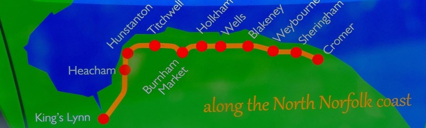
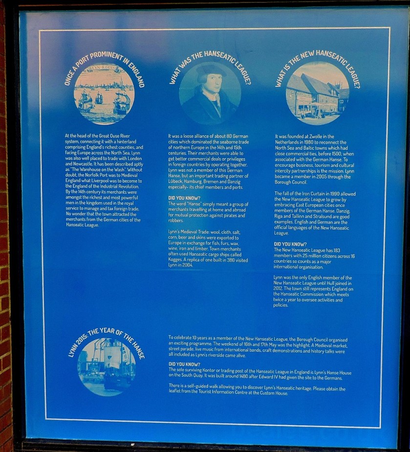
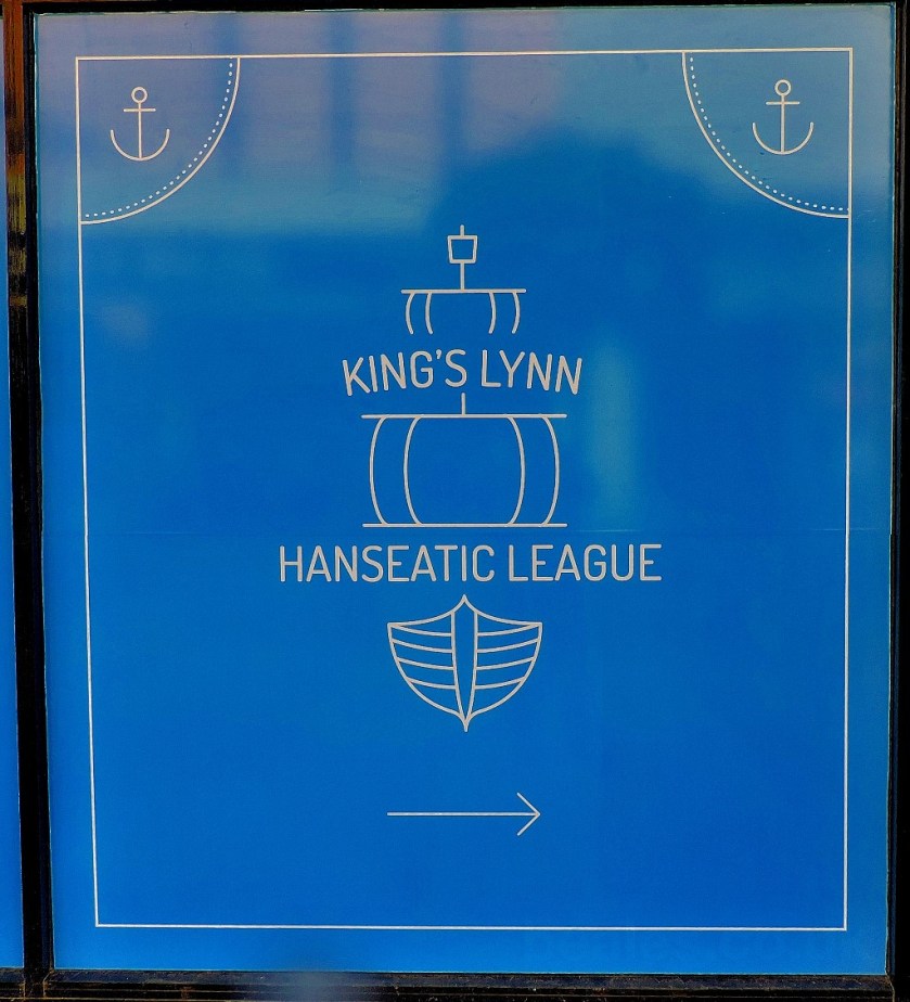
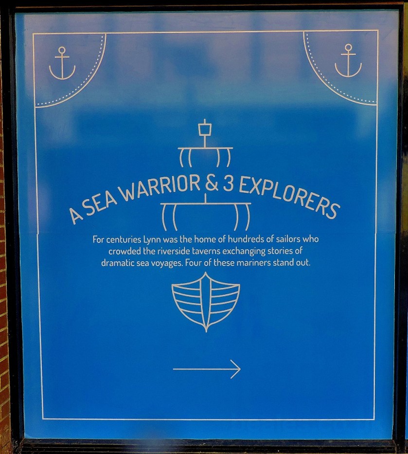
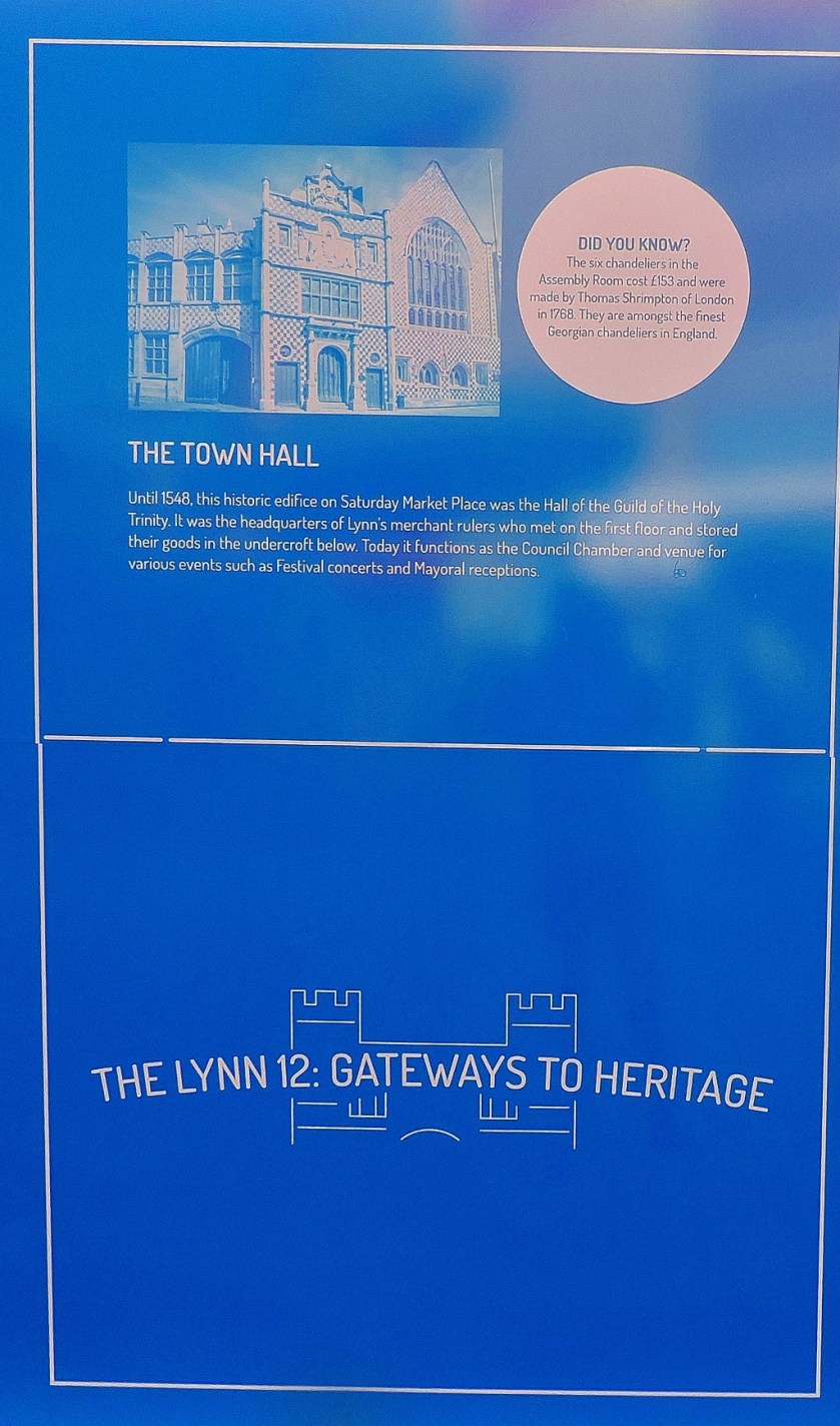
Some musings on the county championship (cricket), and an acknowledgement of King’s Lynn’s latest effort to advertise its heritage.
INTRODUCTION
I am posting about two unrelated matters, hence the title, which is borrowed from a series of Bridge Magazine articles written many years ago by Terence Reese. The firs topic of the day is…
CRICKET
As another English season draws to a close there are two topics to cover in this section, first of all…
A THREE WAY TUSSLE FOR THE COUNTY CHAMPIONSHIP
Thanks to Somerset continuing their late charge with a 10 wicket victory over Yorkshire, and Lancashire earning a draw against leaders Middlesex the final round of games will commence with Middlesex, Somerset and Yorkshire in that order all in contention for the title. Owing to the fact that a decision to alter the structure of the two divisions has meant that there is only one promotion place up for grabs the second division is now settled, with Essex having secured the promotion.
In the final round of matches Middlesex will play Yorkshire at Lord’s, while Somerset face already relegated Nottinghamshire. While my chief emotion as a cricket fan is gratitude that the championship race is going down to the wire, I cannot claim complete impartiality – despite having grown up in London and possessing a Yorkshire surname, it is my support for the underdog that wins out in this contest – I will be rooting for Somerset. Somerset have never won the championship (Northamptonshire and Gloucestershire are also in this position, although the latter were named as champion county three times in the 1870s, before the official start of the county championship in 1890). Apart from being a historic first, a championship win for Somerset this year would also be a fitting reward for Marcus Trescothick as he approaches the end of a long and distinguished career with the county.
The change in the structure of the two divisions mentioned earlier, moving from nine teams in each to eight in first and ten in the second, is not the most significant one happening in English domestic cricket, that distinction going to…
THE INTRODUCTION OF CITY FRANCHISES
Yes, it has been decided by a vote of 16-3 in favour to augment the existing domestic T20 competition with an eight-team city based competition. I am not going to say either yea or nay at this stage, waiting to see how it works in practice before making a judgement. I mark the break between this section and the second section of the post with some recent photographs from King’s Lynn…
This is the uncropped version of a butterfly pictureAnd this is the cropped version.
A CODA TO HERITAGE OPEN DAY
Beales Department Store which is near thus bus station in King’s Lynn has recently closed down. Rather than leave the frontage as blank windows, it has been used as an opportunity to advertise our town’s heritage, as shown below…
Save for the planning notice at the end, these pictures are presented in the order in which they were taken.
The conclusion of my series about Heritage Open Day.
INTRODUCTION
This post completes my account of this year’s Heritage Open Day in King’s Lynn.
A HOUSE, A CLUB AND A FERRY
On way out for my afternoon’s explorations I poked my head round the door of the Rathskellar, but decided not to go in. Queues and crowds notwithstanding I decided that my first port of call of the afternoon would be…
CLIFTON HOUSE
This house is the residence of the current head of English Heritage, and featured rooms open to the public on five different levels, and viewing area on yet a sixth (basement, ground floor, the four intermediate floors of the tower and the roof of the tower). The first part of the building that was opened up featured the cellar, the kitchen and a couple of rooms which could be viewed but not entered. I started by going down to the…
CELLAR
When the house was first built the cellar had been accessible direct from the river (which is now about 50 yards west of the house), and a system of ropes and pulleys was used to offload cargo…
The first three pictures were taken en route to the cellar.
Note the vaulted ceiling of the cellar.Three iron rings through which thick ropes could run enabled cargo to winched from boats into the cellar. I am not certain if all three are visible in this picture, but I tried to show them all.
After the cellar, it was time for the rest of that part of the building, and on towards the tower by way of…
THE KITCHEN
There were some very interesting things to be seen even though this had the feeling of being merely on the way to somewhere else, because of course what everyone was really interested in seeing was the tower.
These canons were in a reception area just outside the kitchen.The remaining four photographs were all taken in the kitchen.
Apart from one last major queue because of limitations on the number of people being allowed in there at any one time (for obvious safety reasons) it was now time to venture the…
TOWER
There were interesting things to see on each level of the tower…
These antique maps and the model of the house were on the first floor of the tower.
One floor up was a room set up for a Jacobean supper.
This room was a further floor up
The ‘Prospect Room’ is one floor below the roof.
The views from the roof were amazing. Conscious of the number of other people who were waiting to savour the views I restricted myself to a few minutes taking the view from all angles, before heading back down.
Looking towards The WashThe Lower Purfleet from above
The view focussing between St Nicholas Chapel and the docks.
My humble abode viewed from the top of the Clifton House Tower.
Leaving Clifton House I headed for Ferry Lane, where I paid a call at the premises of
THE OUSE AMATEUR SAILING CLUB
This establishment, which has about 5o sailing members and somewhere around 500 ‘social’ members had opened its Ferry Bar to the public for the day. I consumed a pint of a splendid beer brewed in Lowestoft (just into Suffolk, but possibly close enough to count as local, especially as the other featured brewery is based in Southwold, a little further away). Having purchased my drink I took some photos inside…
I then went outside on to the balcony overlooking the Great Ouse, and took some photographs from this great vantage point…
It was at this point that my attention was caught by something downriver, which turned out to be…
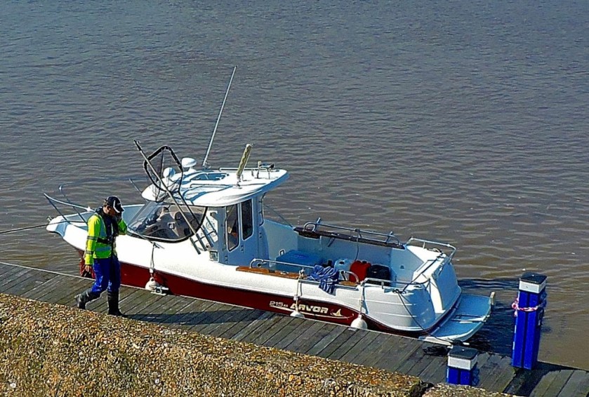
THE ARRIVAL OF A FISHING BOAT
Given the role that fishing, and indeed the sea as a whole has played in the history of our town this was a particular splendid sight…
The first glimpse.
Turning into the docks and therefore presenting a side-on view.
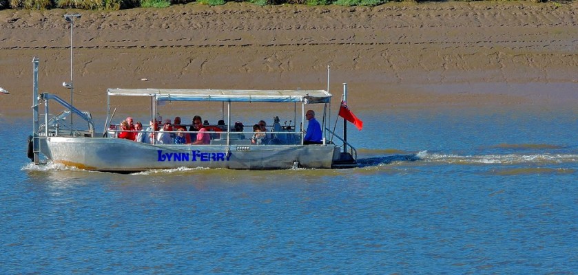
After finishing my pint I headed for the
FERRY
I finished my day by taking the special ‘Heritage Open Day’ trip on the ferry, which involves a small amount of travel along the river as well as across it. This was my first trip on the new ferries, which are equipped with caterpillar tracks for crossing the exposed mud at low tide. The King’s Lynn Ferry has been in operation for over 800 years.
The other historic bus (my second post in the series featured the one put on by Towler’s), this one a routemaster.
A continuation oof my personal Heritage Open Day 2016 story which takes it up to lunch.
INTRODUCTION
This is my second post about Heritage Open Day 2016. There will be one more covering my post lunch activities.
THE ATTRACTIONS
On leaving the London Road Methodist Chapel I walked through the parkland and past the train station to the edge of the bus station and the..
LYNN MUSEUM
I took advantage of the fact that it being Heritage Open Day admission was free to have a look round this establishment. The trip round the museum starts with…
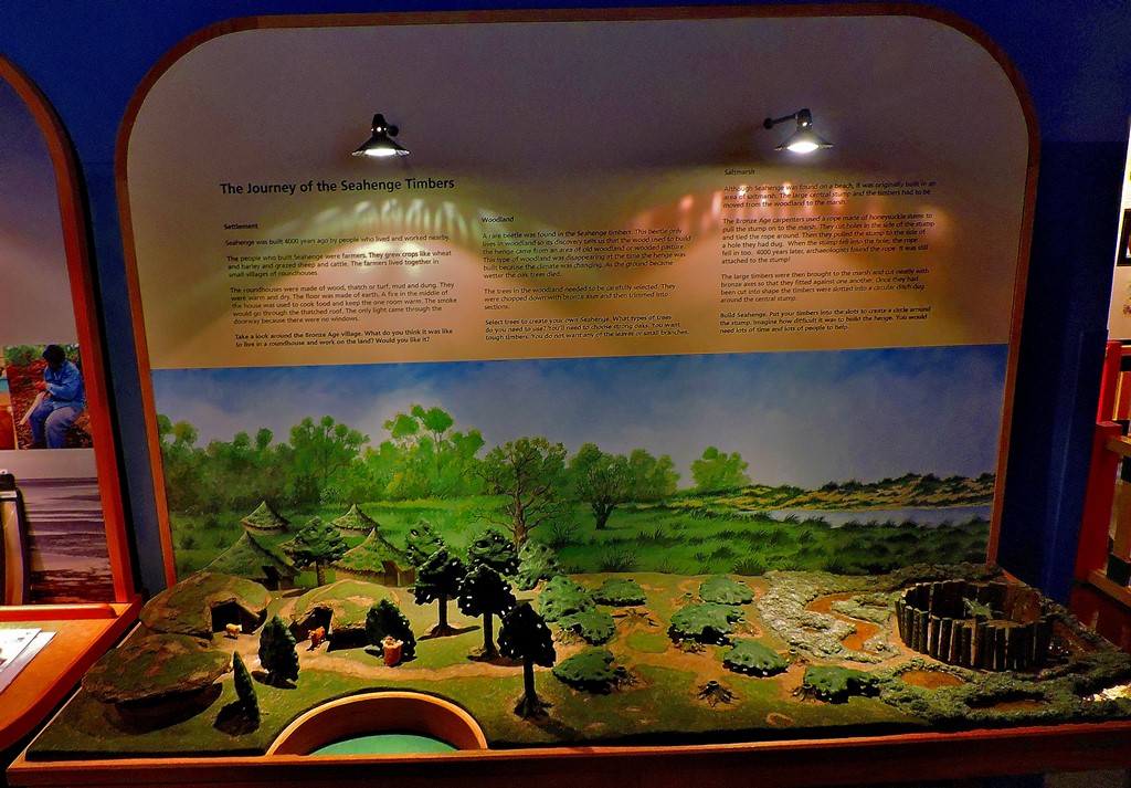
SEAHENGE
This is a circle of standing timbers revealed by a particularly low tide (the North Sea coast has been progressively moving west since the end of the last period of glaciation some 10,000 years ago, and a lot of land from even historic times is now below the surface, including the well known fishing grounds now called Dogger Bank) and ever since taking its place in the museum has been the prime exhibit…
This is one of two historic buses doing duty on the day, of interest because Towler’s are local, being based near Wisbech.
There was too much reflection from this side!
These last two pics are of a speculative model of Seahenge in it’s original surroundings.
The rest of the museum, although it plays second fiddle to Seahenge is by no means devoid of interest either…
King’s Lynn circa 1967My part of Lynn, circa 1967This sort of poster could do with being pressed back into service!
With apologies for the reflections, about which I could do nothing. This was a marine reptile and a contemporary of some dinosaurs but not a dinosaur itself.
After this museum I got an inside look at something I had witnessed being worked on from my own humble abode…
NEW BUILD ON BAKER LANE
This owes its presence on the Heritage Open Day roster to the fact that it is in a conservation area and therefore obliged to be in keeping with what is already there. The stairs by means of which my flat is accessed are directly across Baker Lane car park from this development. I was reasonably impressed by what I saw…
I next paid a brief call at the building on Queen Street (Baker Lane is a side street off Queen Street) where the Civic Society had set up shop, where my eye was caught by this tapestry map of Norfolk…
I saw three more places before breaking off for lunch…
ALMSHOUSES, A COLLEGE AND A SECRET GARDEN
The Victorian almshouses, which like the Baker Lane development are visible from my flat, allowed admission to the upstairs of the front of the building and to a courtyard..
The Great Hall at Thoresby College has something in common with Headingley cricket ground – looking up is better than looking down!
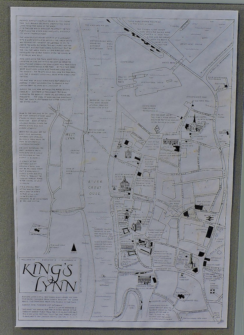
This is why I recommend that visitors to the great hall at Thoresby College look up!This A3 sheet shows some of the attractions in and around King’s Lynn
The secret garden mentioned in the header of this section is behind Hampton Court, where my aunt lives. The land-facing wall is an old warehouse frontage which back in the day (14th century) abutted directly on to the river so that cargoes could be offloaded direct into the building. Later, when the river had assumed its current position, about 50 yards west of the old warehouse the site of what is now the garden was a waste dump. There is one original door, which used to provide access to Summerfeld & Thomas.
LUNCH
My aunt had laid out some food on her kitchen table, for which I was very grateful. It was very good food too.
This post arises from several issues: changes to the bus services in my region, and the way in which the company in question has handled those changes; a campaign that has recently come to my attention to restore rail links to Wisbech, and finally the fact that I have recently been in Sweden and thus privileged to see at first hand how a properly run public transport system works.
PUBLIC TRANSPORT SHOULD MEAN PUBLICLY OWNED TRANSPORT
The more I see of public transport (and as a 41 year old non-driver I see plenty) the more convinced I become that private companies should play no role in running it. Whether you consider the blatant failures such as the current situation involving Southern Rail, the high and increasing prices of tickets across the board or the frequency with public transport in Britain is affected by delays or suspensions of services, it is plain for all to see that private companies cannot do the job.
I regularly see people in Fakenham, where I work, who have missed a connection due to a late running bus. A missed connection means a loss of at least one hour, possibly more due to the infrequency of services.
A NOTE ON INTEGRATION
Those of you who are familiar with my London Transport themed website will have noticed that I am strong believer in integration of services, which is manifested on that site mainly by my suggestions for improvements to existing lines. Ideally all routes would be interconnected.
TWO CASE STUDIES
My first case study concerns…
STAGECOACH BETWEEN KING’S LYNN AND NORWICH
There have been two major changes on this route recently. Firstly, the service between Fakenham and Norwich has been halved (it is now hourly rather than half hourly), albeit with a couple of gaps in the service between Fakenham and King’s Lynn closed to make that a proper hourly service. The effect of the axing of half of the services between Fakenham and Norwich has been that for the first time standing passengers are a regular feature of that route. A week ago today the X8 designation vanished, the whole route now being referred to as X29. While there is a certain logic to taking this step, especially if it means that all Norwich-Fakenham buses go through to Lynn, the way in which it was handled earns Stagecoach a major black mark. Apart from messages on the screens at King’s Lynn bus station (the way I learned about it), this change was given no advance publicity, with the result that those passengers who do not use King’s Lynn bus station were caught on the hop, and even on Friday evening the sight on X29 to King’s Lynn was still capable of causing confusion with certain passengers.
THE TRAIN BETWEEN KING’S LYNN AND LONDON (WITH A SIDELIGHT ON PROPOSALS INVOLVING WISBECH)
The train service between London and King’s Lynn is hourly, and after a non-stop run to Cambridge it splits into two, with four coaches continuing north to King’s Lynn and four returning to King’s Cross. The necessity to be in the front four coaches if going beyond Cambridge can mean standing all the way to that station or even beyond (I have stood from London to Waterbeach at least once). I am aware that the restriction to four coaches beyond Cambridge is due to the shortness the platforms at some the intermediate stations, but there are least two possible solutions, and variations thereon:
In addition to the through services from London run regular (half hourly, or even quarter hourly) shuttle services between Cambridge and King’s Lynn). This (especially with the more frequent services) would mean that not everyone journeying between Cambridge and King’s Lynn or intermediate stations would need to board through trains at Cambridge – I for one would aim to make the return leg of a trip to Cambridge on one of the shuttles rather than a through service.
For points north of Cambridge have an interleaving of shuttle services as above with faster through services calling at only the stations with long platforms (Ely, Downham Market, King’s Lynn), so that services between London and King’s Lynn would consist of hourly through services, with changes at Cambridge, Ely or Downham Market as appropriate for intermediate stations) which would be augmented by shuttle services on the Cambridge-King’s Lynn section.
You will note that I have not even touched on the possibility of lengthening the platforms at Waterbeach, Littleport and Watlington so that eight carriage trains could call at those stations – I have merely mentioned the possibilities that do not require work on the existing infratsructure.
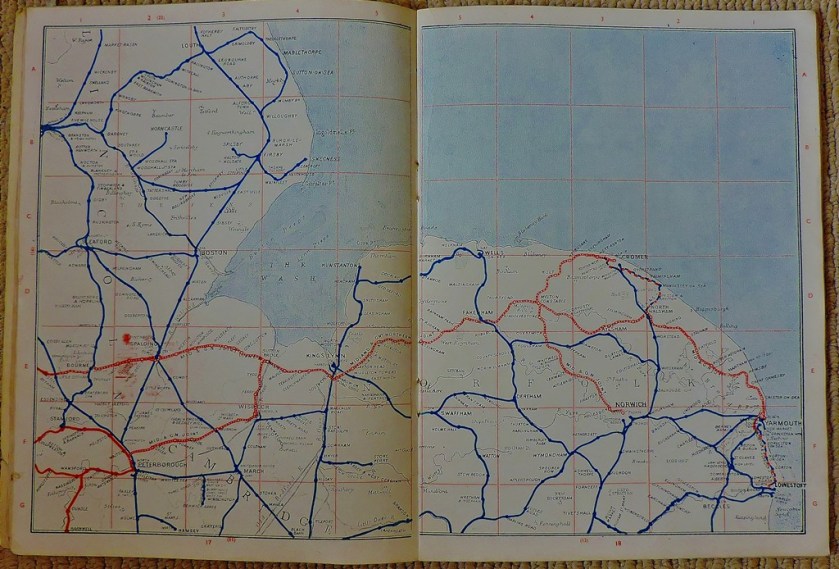
WISBECH RAIL LINKS
I found out about the campaign to bring the railways back to Wisbech via twitter. They have a website which gives considerable detail about their proposals. I conclude this post by aking use of one of more recent bargain basement acquisitions, this what Wisbech’s rail connections looked like in 1947…
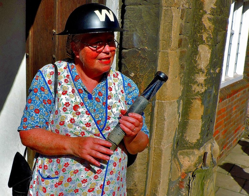
It is now a well-established tradition that Heritage Open Day in King’s Lynn takes place on the second Sunday of September. I had already decided that I was going to concentrate this year on places I had not previously seen. You can see what I wrote about Heritage Open Day 2015 (and indeed the text relating to Heritage Open Day 2014 – the pictures have been deleted due to lack of storage space in my media library) by clicking here. Also, since the whole point of Heritage Open Day is usually inaccessible places are opened to the public the outsides of buildings do not feature very much. The series of posts about Heritage Open Day 2017 will be different again as I have volunteered to help out at one of the attractions.
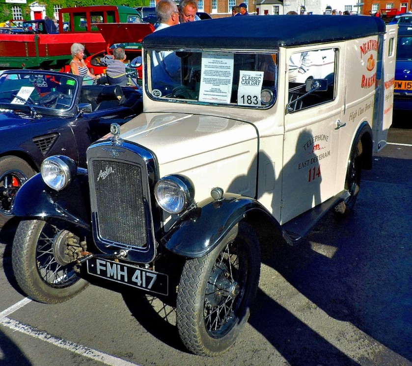
WORKING OUT A PLAN OF CAMPAIGN
The weather on Saturday had been downright bad, so it was with relief that I looked out of my windows to see blue sky and bright sun. Leaving my flat at 9:30 (living in the heart of the town it is almost a case of leaving my flat and instantly being in the action I headed for the Tuesday Market Place where I picked up a brochure about the day, and took a photograph of one of the classic cars…
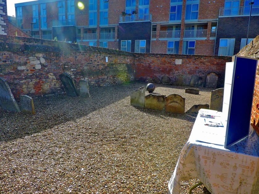
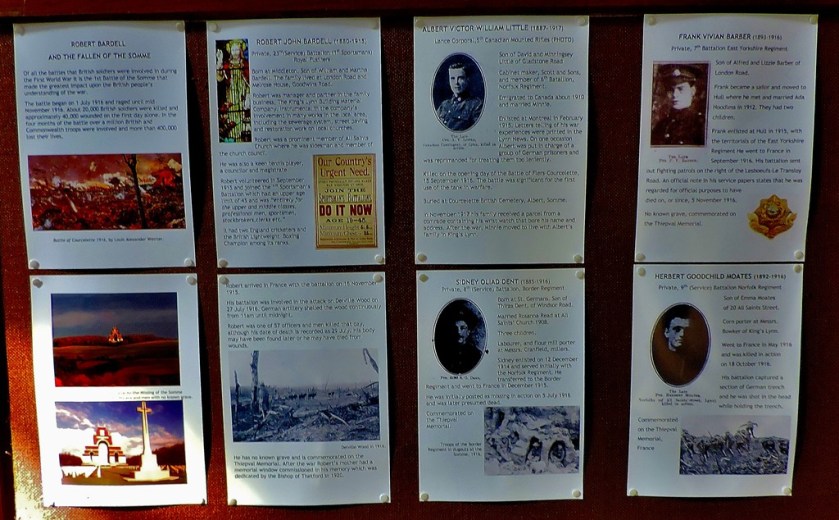
Having established that All Saints Church, a small establishment concealed from wider public knowledge by Hillington Square, was not opening up until 11:10 I set off to do other things until it opened (I was determined to see inside it, having photographed the outside a number of time). I was delighted to note that the Jewish Cemetery was open, and took a closer look at this little landmark that I previously viewed only through a locked gate.
THE JEWISH CEMETERY
This is a fascinating little place, and there was lots of information on display. This made an excellent first attraction of the day:
Information first (pics 1-7), then some general pics)
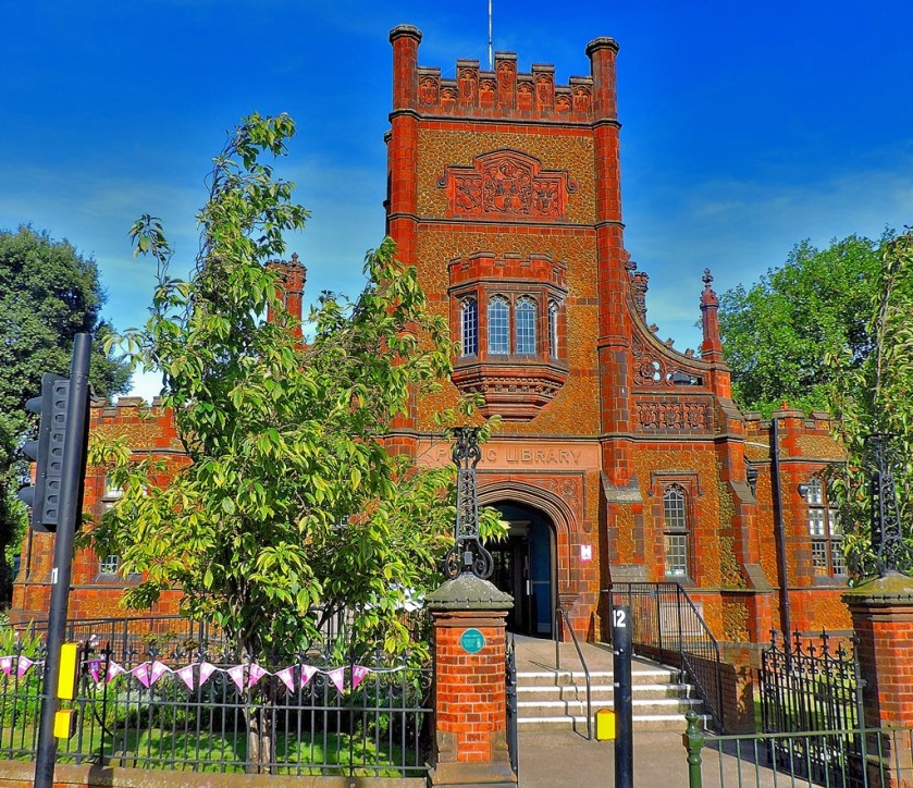
Just across the road from the Jewish Cemetery is…
THE PUBLIC LIBRARY
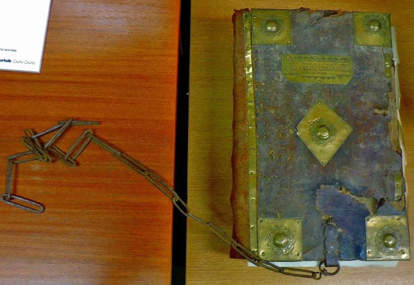
There cannot be many people who are more familiar with the areas of this building that are open to the public on a regular basis than me, but I had not previously seen either the manager’s office or the turret room (home to the Stanley Collection, a gift from the 15th Earl of Derby). Unfortunately I was stopped from taking photographs, so I have no pictures of the latter collection, and only a few from the manager’s office.
This was one way to make sure your books did not get stolen!
Passing through The Walks I spotted that the fountain had had some kind of bubble bath added to it…
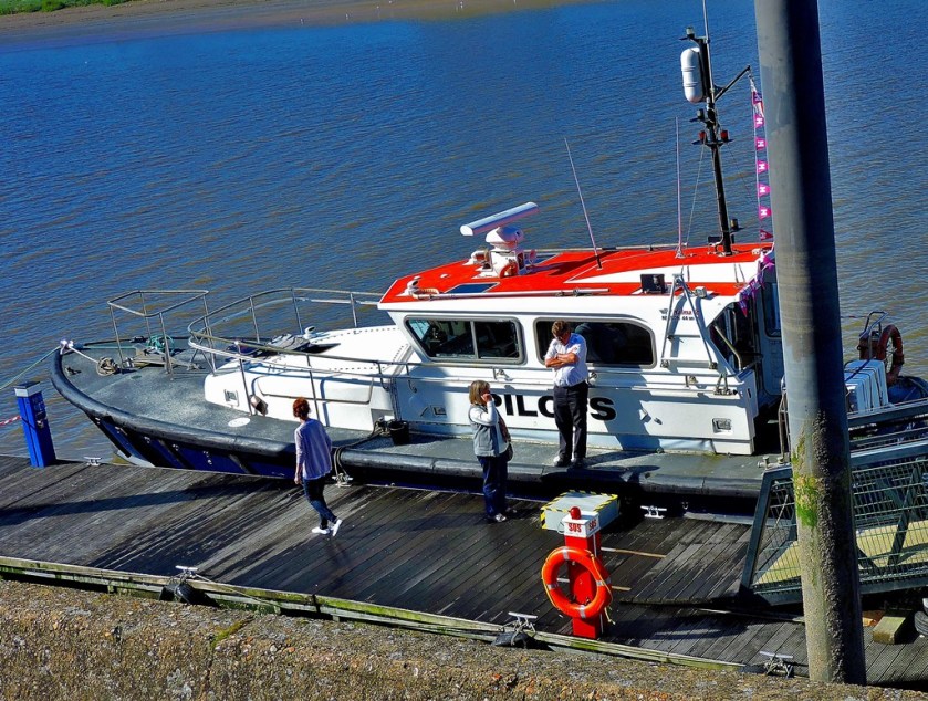
My next port of call was South Quay, where there was a…
A ‘PILOTS’ BOAT
The pilots in question are responsible for ensuring that ships dock safely, and in the case of the team on this boat the area includes the Great Ouse from just north of Downham Market to the Wash and also the mouth of the Nene, the river which serves Peterborough. As part of their responsibility they position buoys to indicate dangerous areas (it takes about ten minutes to shift one of these buoys once it is in position because they are anchored into position by one ton blocks of iron. There was one such on display so we could see closer than usual what they look like.
The Pilots BoatA rowing crew approaching the jetty.
The buoy (two pics thereof)
Marriott’s, viewed from the ramp down to the jetty, thriving as would be expected.
My next port of call was…
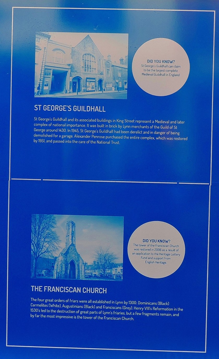
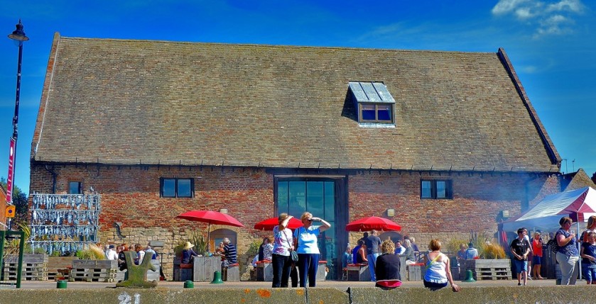
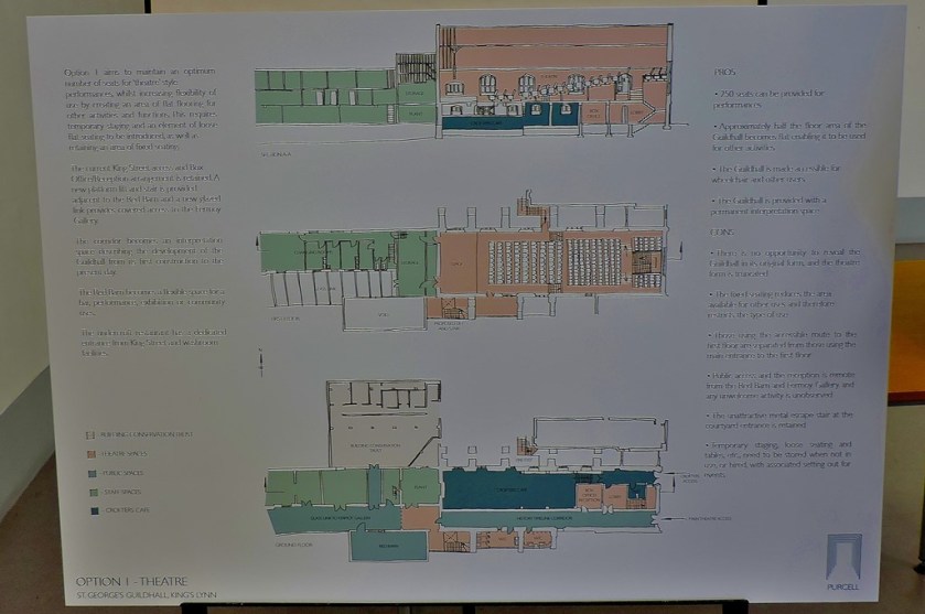
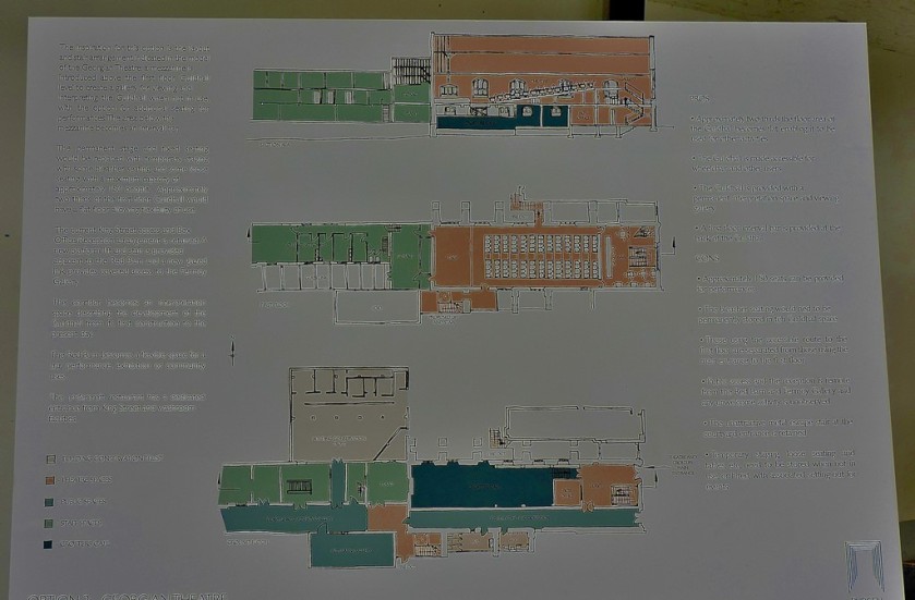
THE GUILDHALL OF ST GEORGE
This was both an opportunity to look closely at a historic landmark and an opportunity to have say in its future. They had three plans on show, and it was the third that I particularly approved of. I filled out the questionnaire that they were using to collect information. This looked like being a real consultation ( as opposed to for example ‘we are building a new road, where would you like it to go?’ or ‘we are building a new runway, which airport would you like to get it?’). Once you have seen the photos below and before reading on, why not see if you can guess which plan I liked best…
My preferred option of those on show was the third one. I hope that this building’s theatrical connection which stretches back six centuries will be maintained.
Walking through the Vancouver Quarter on my way to the next landmark I was pleased to spot a disused shop being put to good use…
Finally, it was time to visit…
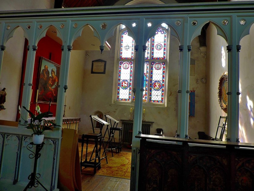
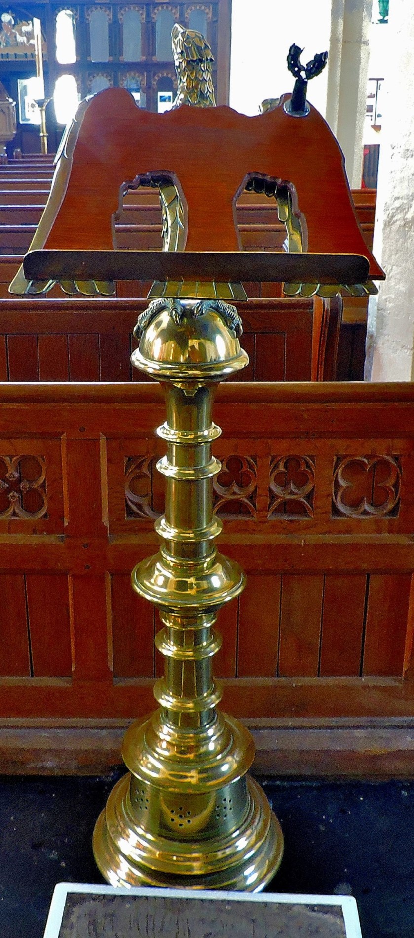
ALL SAINTS CHURCH
This little church is reckoned to be the oldest in King’s Lynn, with parts of the current building dating back almost a thousand years. On the outside it is an attractive building, on the inside…
I finish this post with the last religious establishment I was to visit…
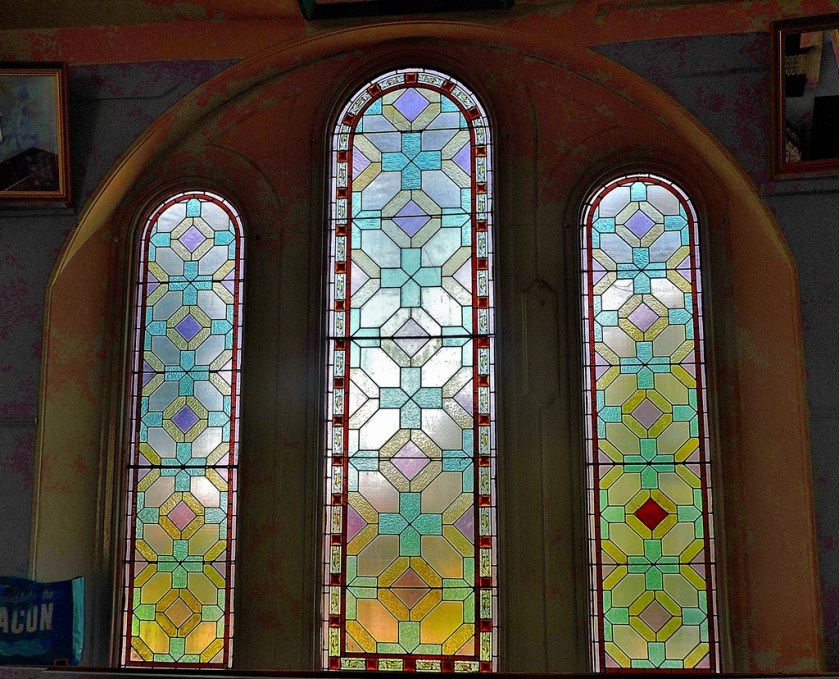
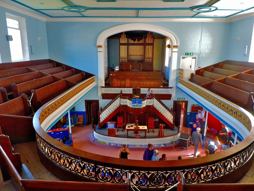
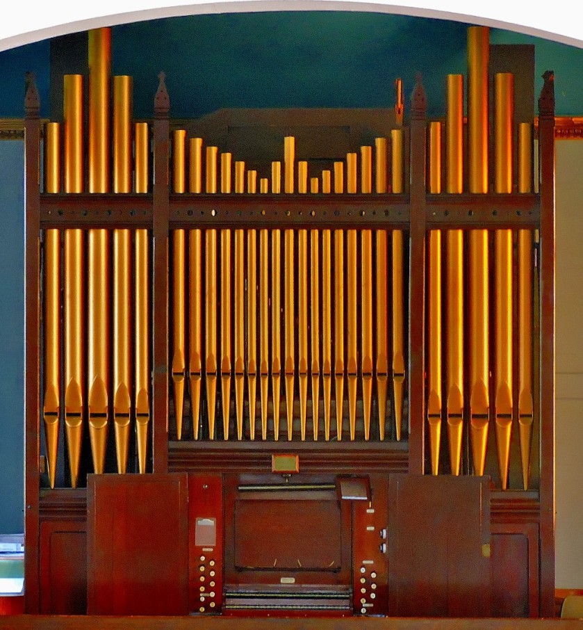
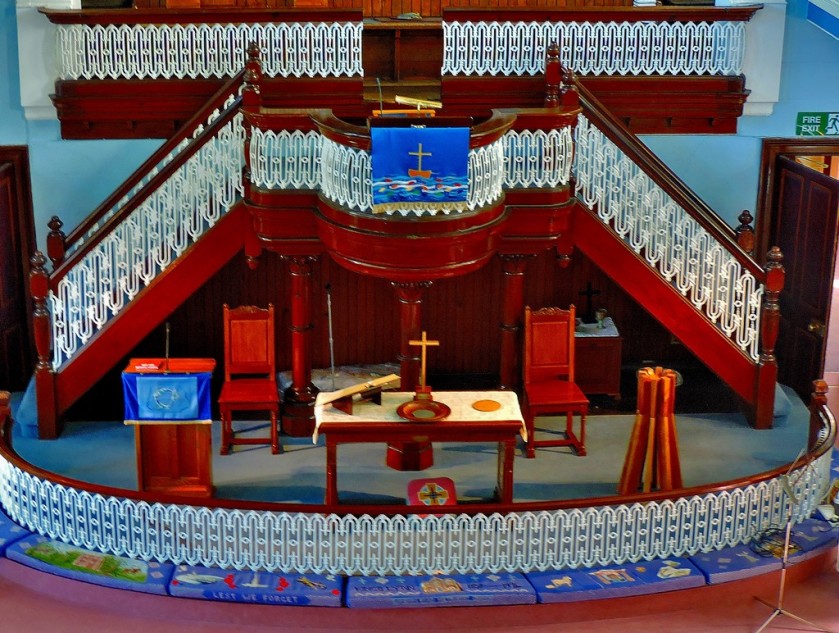
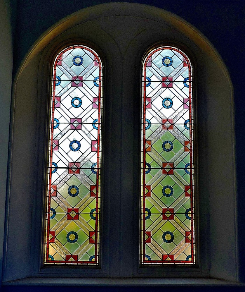
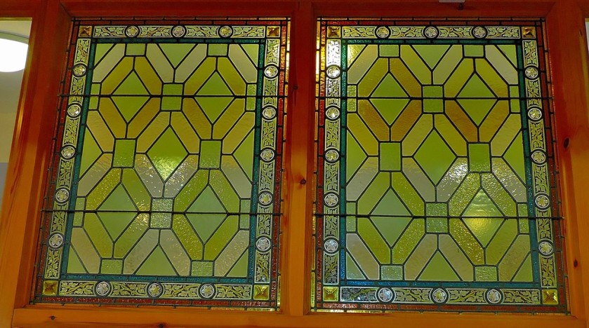
LONDON ROAD METHODIST CHAPEL
On the outside this is a smart but unspectacular brick fronted building. The inside of the building is very impressive…
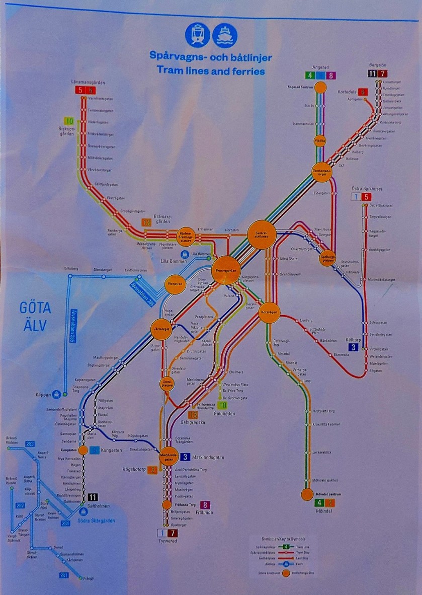
This post ties together my series about my recent holidayy in Sweden, displaying lots of maps and functioning as an illustrated index.
INTRODUCTION
Welcome to this post which ties together my series of posts about my recent (July 29 to August 13) holiday in Sweden and functions as a sort of illustrated index to the series. Please note that barring the two Lulea maps which are public display maps as I did obtain a map of that town every map you see photographed here is available free of charge (great news for a cartophile such as myself).
THE MAPS
Maintaining chronological order for these maps we start with…
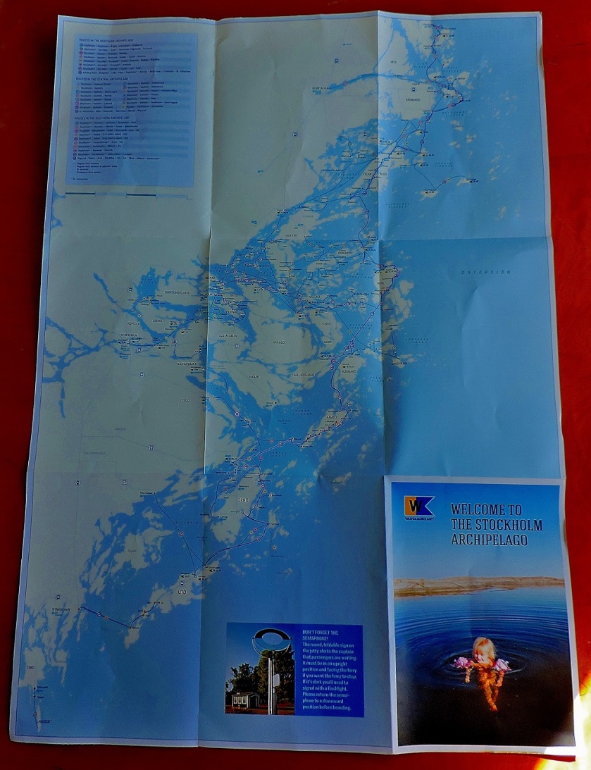
STOCKHOLM ARCHIPELAGO
This map relates to the start of the holiday, the period of July 29th to 31st, which is covered in this post:
On Monday August 1st I set off on the second part of my trip, where I was travelling solo, my first stop being…
KRISTINEHAMN
This small town was significant for me as being the southern terminal of Inlandsbanan. It sits close a famous lake (bodies of water are never far distant wherever you are in Sweden) and is an attractive place in its own right.
Kristinehamn features in two posts in this series:
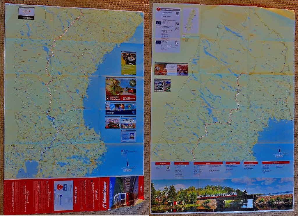
I spent two days soaking up this fabulous railway experience, coverage of which ran to eight posts in the course of this series, which led to me to create a page for easy access to the whole sub=series. I have three pictures of this large double-sided map:
The two sides of the map juxtaposed – the southern part of the route is on the left as you look, the northern on the right (a side by side view works better than one on top of the other for a long thin country).A closer view of the southern part of the routeA closer view of the northern part of the route.
Those who followed this series will recall that my first day of travel along Inlandsbanan took me to…
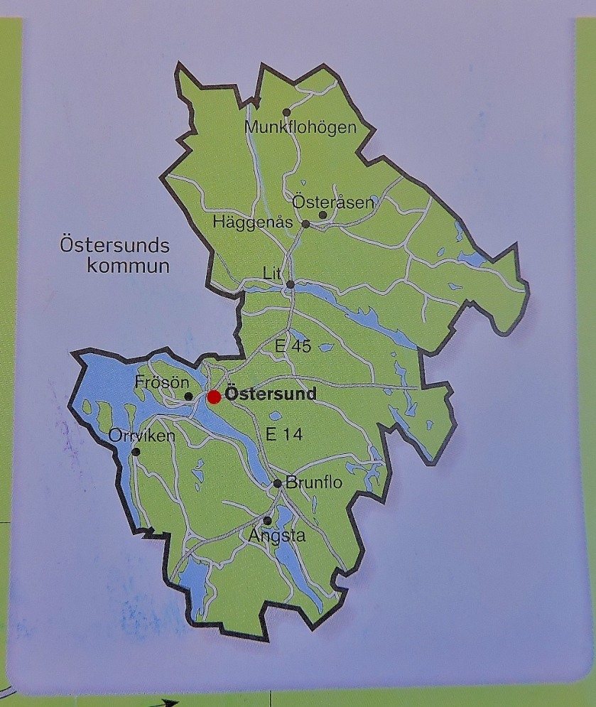
OSTERSUND
I covered the section of the journey from Mora to Ostersund in two posts, using the meal stop at Asarna as a natural break point:
The Ostersund map, shown below, was provided to Inlandsbanan passengers by our host for that part of the journey, Emma, who had been equipped with a block of such maps from which she peeled off individual copies:
Osttersund in its region.The close up of central Ostersund.
The next place I was able too obtain a map was…
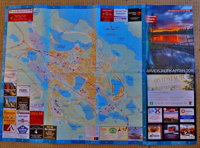
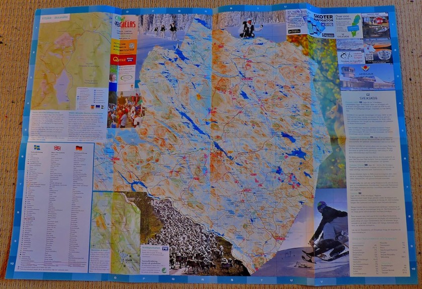
ARVIDSJAUR
This town is fairly close to the arctic cirle. The post in which Arvidsjaur features was the seventh in my Inlandsbanan subseries, meaning that by the time I got to this location all the following had happened:
Not very long after this came the end of the Inlandsbanan journey at…
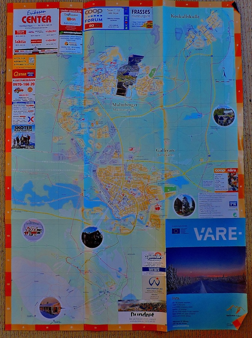
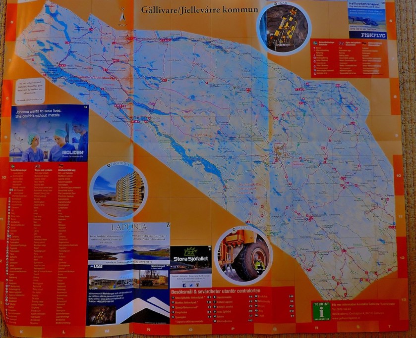
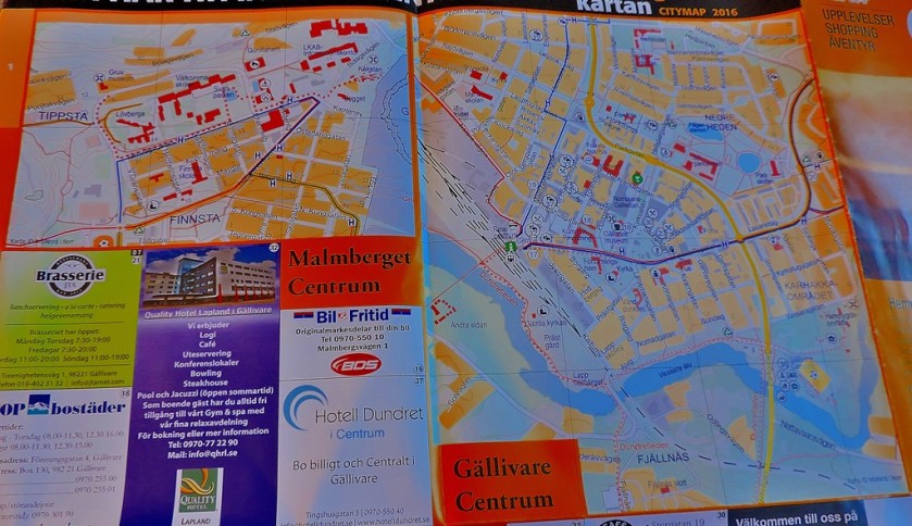
GALLIVARE
As with the Osttersund map this one was provided for passengers by our train host, in this case Andreas, although unlike the Ostersund map it was large enough to warrant being folded, and hence could not be transported in the way that one was…
The post to which the above pictures relate was the last in my Inlandsbanan subseries:
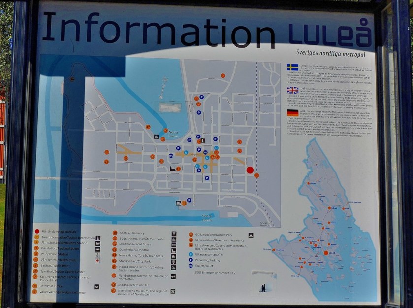
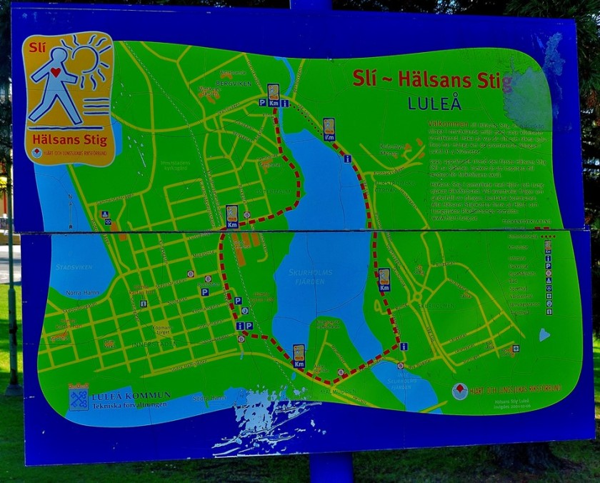
An attractive town that sits at the northern end of the Gulf of Bothnia, Lulea was the only place I visited for any length of time that I did not get a take home map of, but I have two good pictures of public display maps:
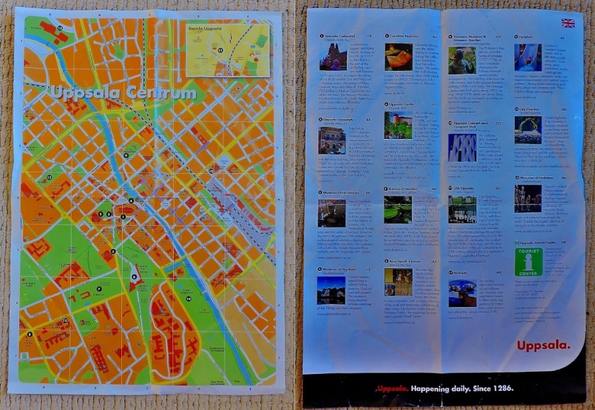
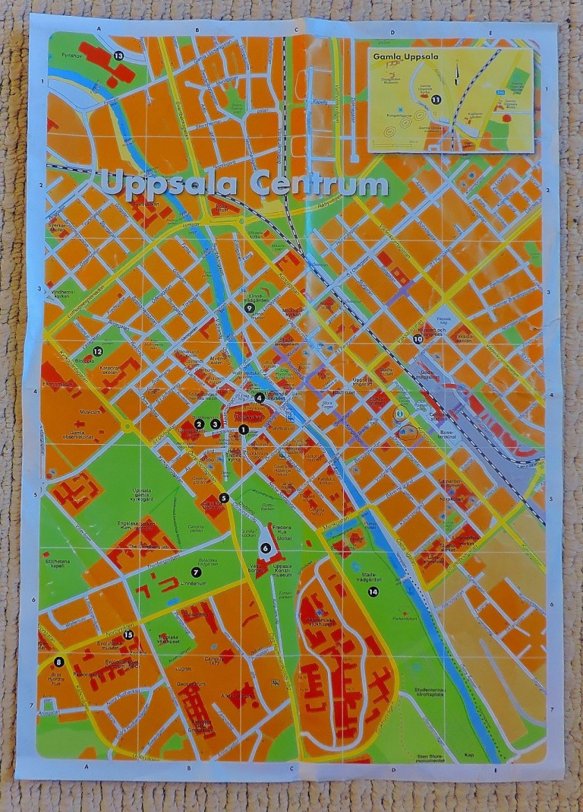
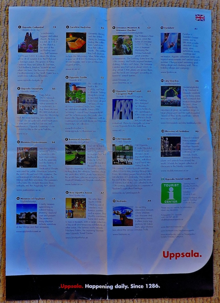
The map of Uppsala tthat ii was equipped with at the tourist information office had details of various attractions printed on the back…
Both sides of the mapClose up of the MapClose up of the list of attractions.
Uppsala provided me with six blog posts worth of material – anyone who is up for a little challenge is invited to work out how many of the attractions listed above get mentioned in the course of the series of posts:
As the title of the last post listed above suggests, my next port of call was…
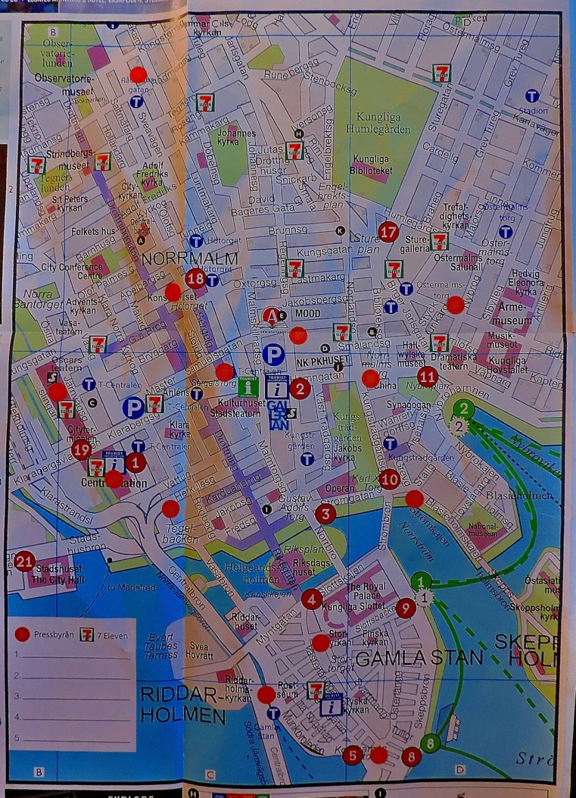
MALMO
The map of Malmo, provided by the STF Hostel in which I stayed for two nights, was A3 sized (twice as big as the Uppsala map), but had only advertising on the reverse, hence me not bothering to photograph that side…
As with the Uppsala series, the title of the final post featuring Malmo gives a clue as to my next port of call…
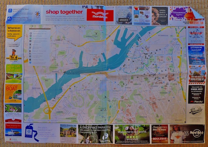
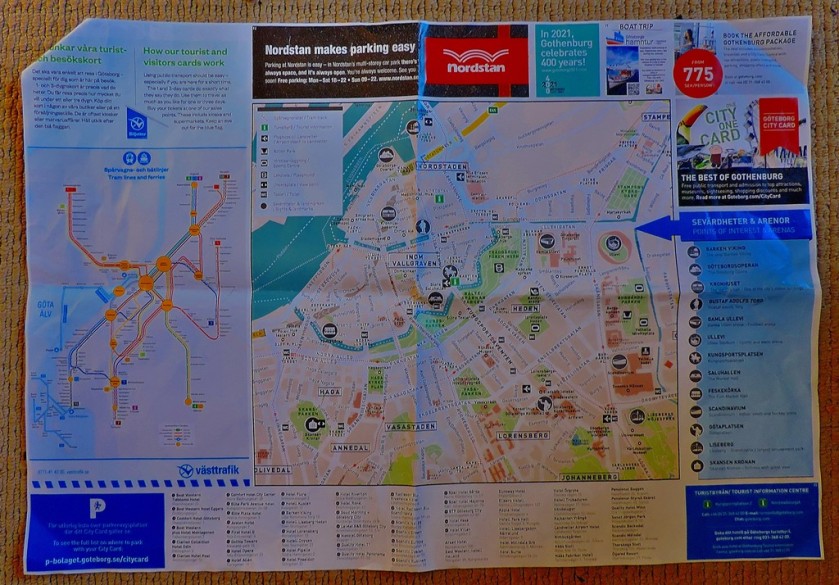
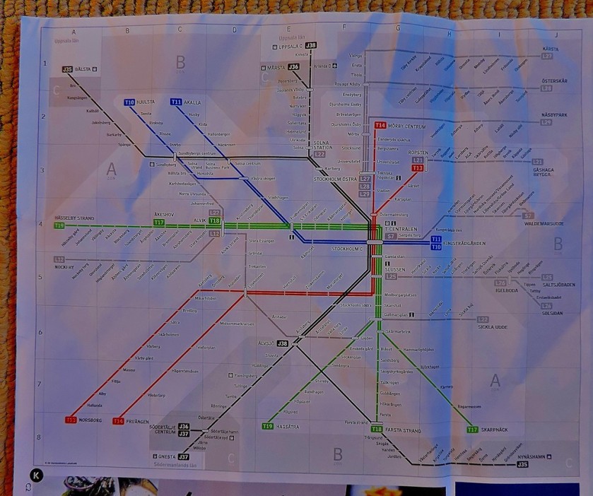
GOTHENBURG
The Gothenburg map, provided by the tourist information office, has useful information on both sides…
As well as both sides of the map, I include a close-up of the diagram of the local public transport network
I stayed only the one night in Gothenburg, en route back to Stockholm for the last two nights of my stay in Sweden, which explains why this very impressive city only features in two posts:
In spite of the title of the last post shown above this post is not quite done yet, because being the keen student of public transport systems that I am I could not ignore one of the most remarkable I have yet encountered…
TUNNELBANA
The heading above contains the colours of the three lines that make up Tunnelbana, with the blue line given an extra letter over the others because of its cave-like appearance. Here is a diagram of the Tunnelbana system:
Tunnelbana has a whole long post to itself, and also provided my response to one of Maria Jansson’s photographic challenges:
I hope that you enjoyed this ‘maps special’ and that some of you will find it useful as a means of accessing my series of posts about Sweden. For those who have enjoyed the maps, i draw your attention to a blog that is dedicated to maps.
Welcome to the latest installment in my series of posts about my holiday in Sweden. After this post there will be a ‘maps special’ which will tie the whole series together.
A VERY EARLY START
With my flight to Gatwick due to leave Arlanda Airport at 7:30AM there were two ways I could get to the airport early enough in the morning. I could either take a significant length walk to a ‘flygbussarna’ stop and get a bus to the airport, or I could get a tunnelbana train at 4:22AM and catch the Arlanda Express from Stockholm Central (the main station would not be open, but the Arlanda Express terminal would). I opted for the latter, borrowing an access card for the tunnelbana which I have subsequently posted back to Sweden.
I departed the flat in which I had stayed for my last two nights in Sweden at 4AM, aware that I would not be able to access Huvudsta station by way of the shopping centre, but would instead have to walk round to the official tunnelbana entrance. I arrived at T-Centralen with plenty of time to make the long interchange, purchase my Arlanda Express ticket and board the 5:05AM train.
ARLANDA AIRPORT
Regular trains have a station called Arlanda Central, and you have to pay a premium to access the airport from there. The Arlanda Express calls at two stations, Arlanda South and Arlanda North, and the premium for using the airport is more than included in the cost of the fare. For my flight Arlanda North was the station, and a combination of the speed of the train and the smoothness with which I progessed through the airport means that I was seated close to the departure gate over an hour before the flight was due to take off. Here are the last photos from this holiday…
The first four pictures are at Huvudsta awaiting the train to T-Centralen
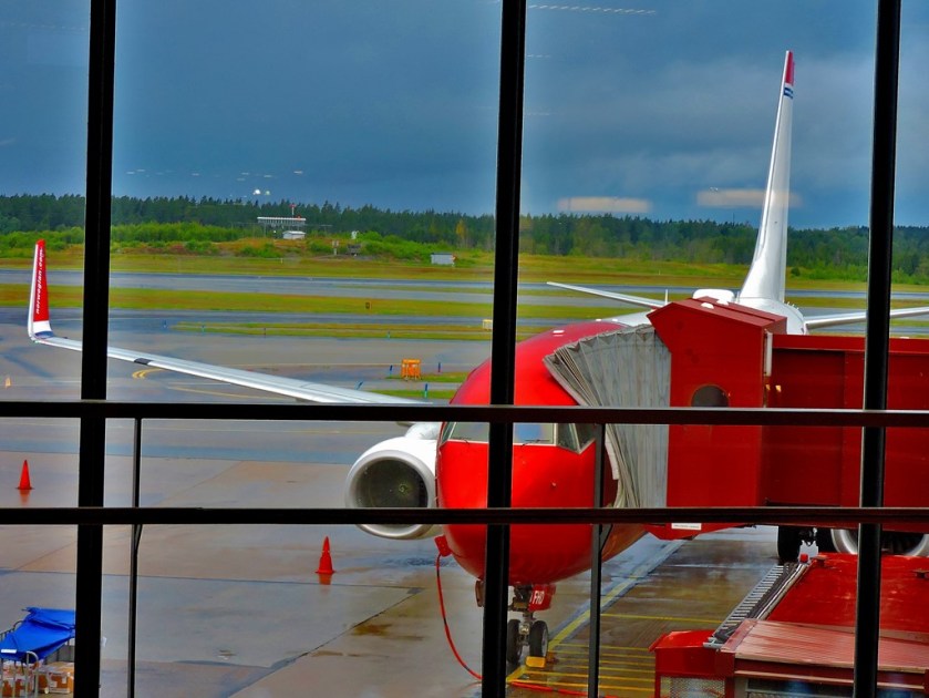
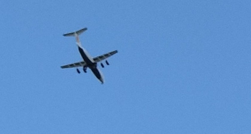
The plane I would be travelling to Gatwick in viewed from the departure gate.
GATWICK TO KING’S LYNN
Apart from a bit of a wait in the baggage hall because I had arrived there before the bags from our flight did I passed through the airport without incident, and was able to catch the 10:30 Gatwick Express to Victoria (one could do the journey changing just once from St Pancras to King’s Cross, but the slowness of the Gatwick – St Pancras service means that this costs in time terms), which in turn meant that I got to King’s Cross in time to catch the 11:45 to King’s Lynn, and was thus back at my flat before 2PM. On the Gatwick to Victoria leg of the journey I found myself playing good Samaritan to some American tourists, who knew where they were staying but not how to get there. As befits someone who runs a website about London transport I was able to advise them as to the best routes.
The latest in my series of posts on my holiday in Sweden.
INTRODUCTION
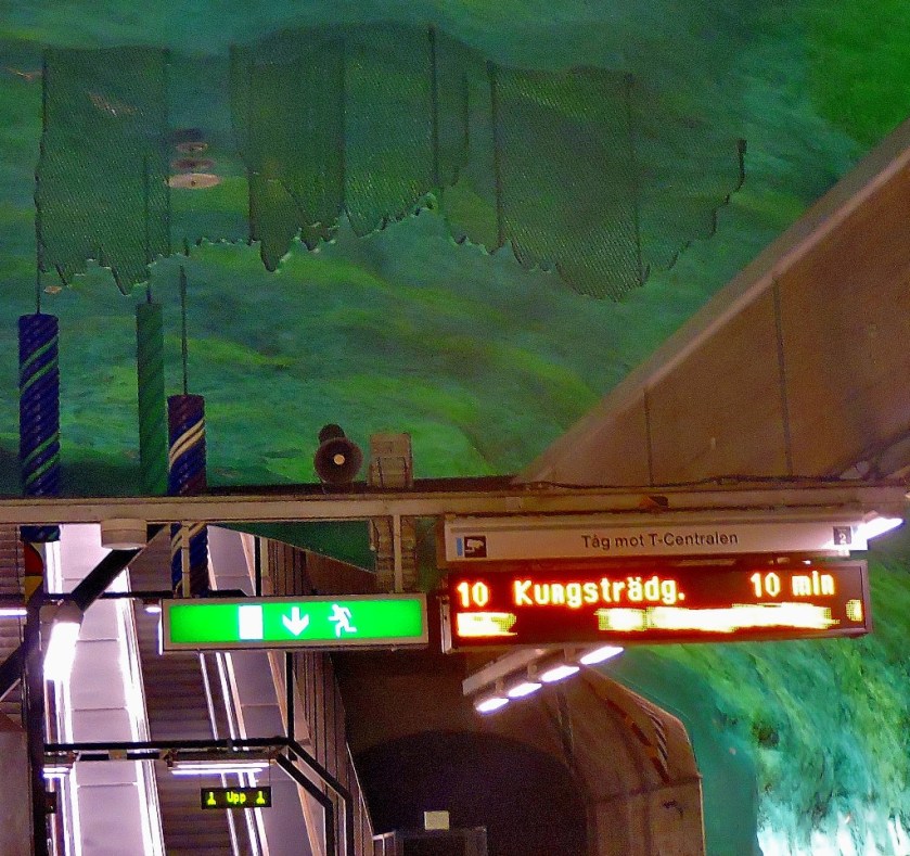
Welcome to the latest installment in my series of posts about my recent holiday in Sweden. Having covered Gamla Stanin my previous post it is now time to cover the other area where I did some exploring, Kungstragarden, the city centre terminus of the blue line on Tunnelbana.
AT THE SURFACE
It was obvious as soon as I had exited the station building that I had made a good call. Here are the first couple of pictures..
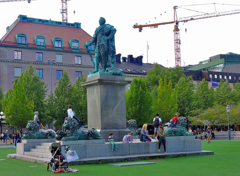
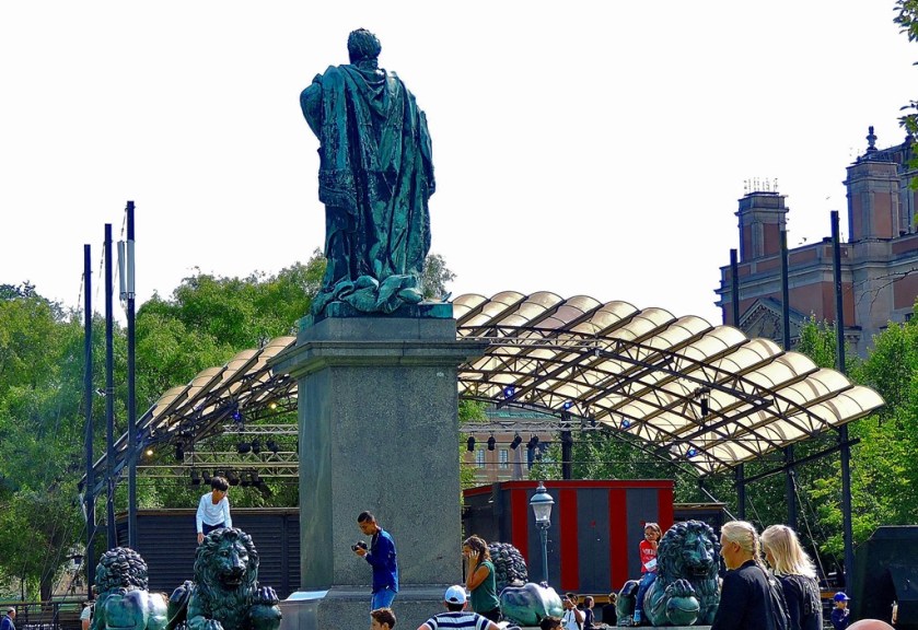
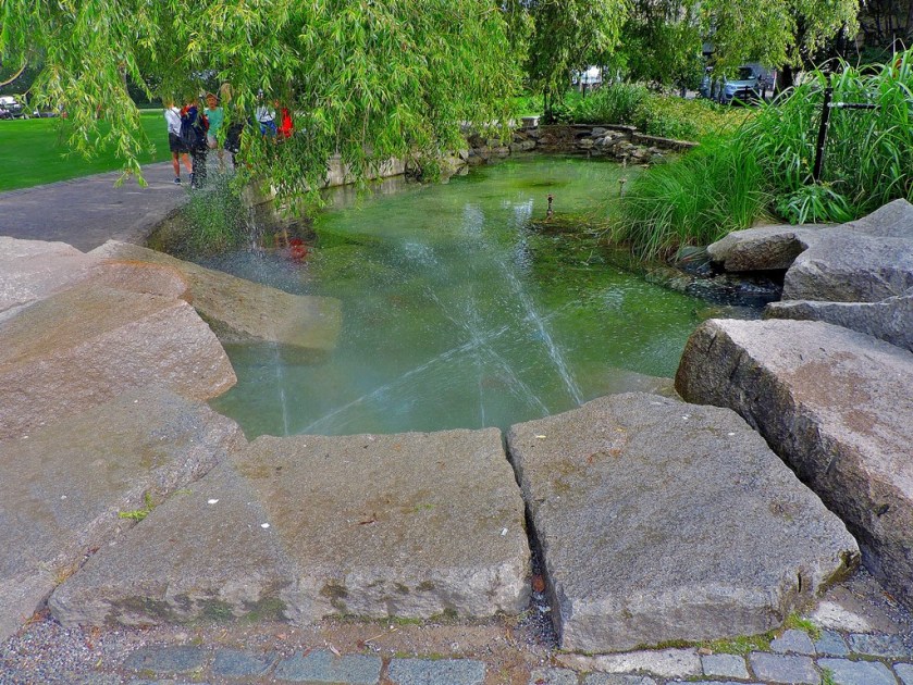
THE KUNGSTRAGARDEN
On entering the Kungstragarden itself the first thing I saw was this:
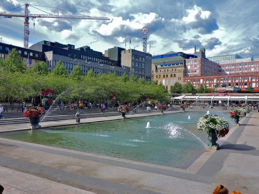
Beyond this is a very decorative pool…
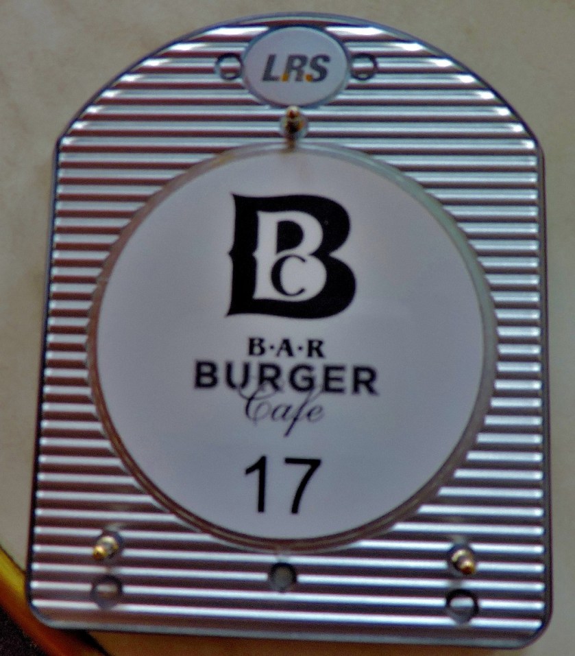
By this stage I was thinking about lunch, and one of the various beer and burger places caught my attention. I was lured in by the ‘Nick the Greek’ burger – lamb, feta cheese, salad. I subsequently identified an impressive looking local beer, and food ordered took my place at an outside table.
Avenyn Ale – it proved by excellent.When you place a food order you get one of these, and your food arrives is due course.The reverse shot.
Although I was well aware that a the general expectation is that one will not eat the top half of the bun in which a burger of this nature is served I was not about to leave anything uneaten. Lunch done I resumed my explorations, looking to take a circuitous route back to the station…
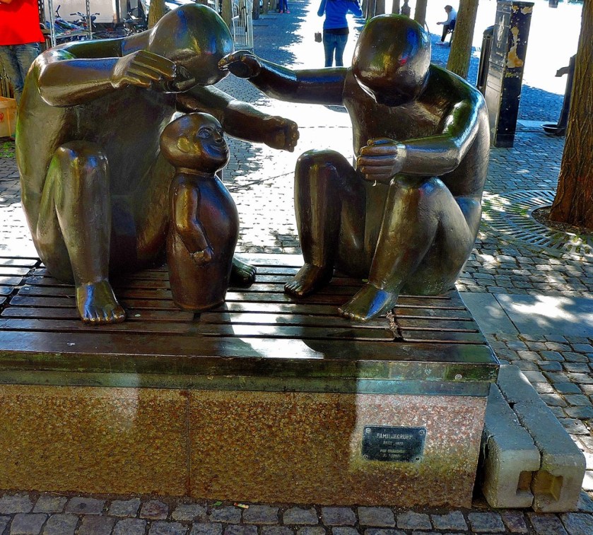
My nest port of call was a park…
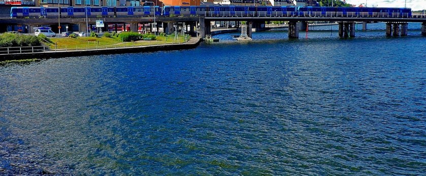
I was then drawn towards a waterfront (Stockholm like most Swedish cities is well supplied with water)…
There were a few more things to photograph before I got back to the station and resumed my explorations of the Tunnelbana.
Kungstragarden well repaid the time I spent exploring it, and I would recommend anyone visiting to Stockholm to include it in their itinerary.
The latest post in my series about my holiday in Sweden.
INTRODUCTION
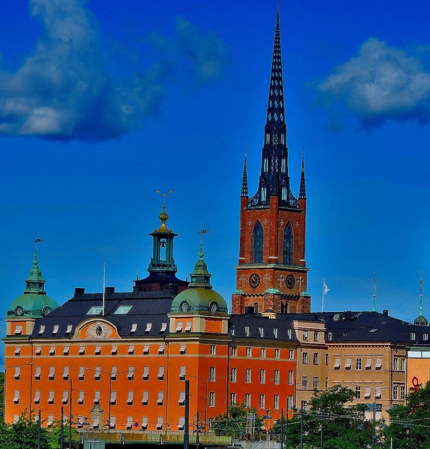
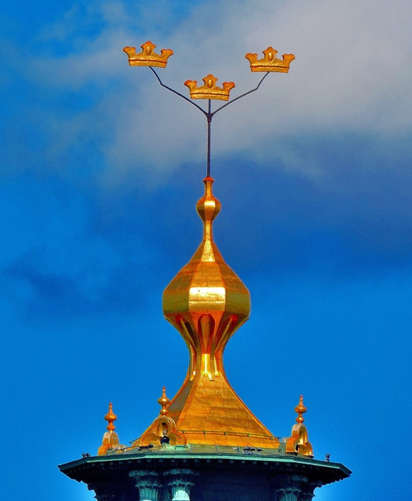
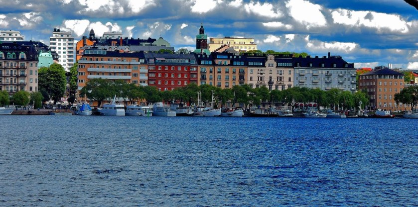
Welcome to the latest installment in my series of posts about my recent holiday in Sweden. Readers of my previous post will recall that I alluded briefly to a waterside walk that started and finished at Gamla Stan. This post tells the story of that walk. I also included some pictures from the city of Stockholm in the first post in this series.
AT GAMLA STAN
Although it is on what is classed as an underground railway the station at Gamla Stan is actually slightly elevated, so that you exit it by going down to street level. It had always been in my plans to do some exploring around Gamla Stan and the sight of the waterside was enough to decide exactly what I would be doing…
THE WALK
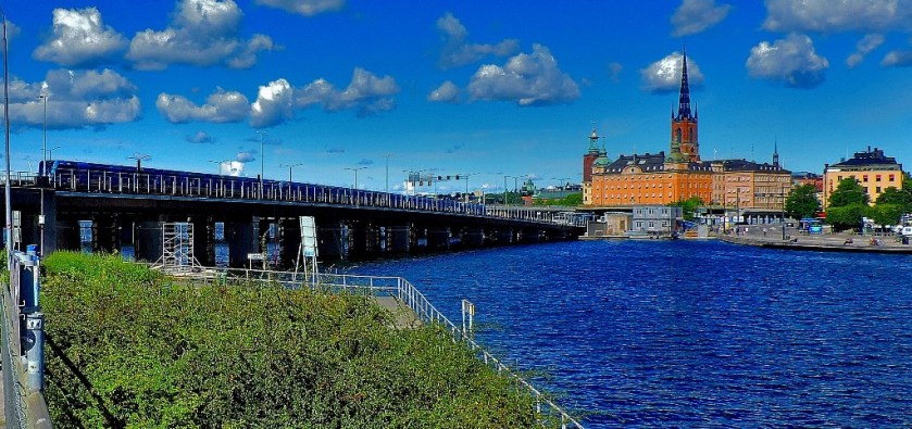
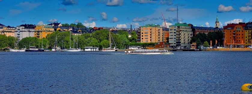
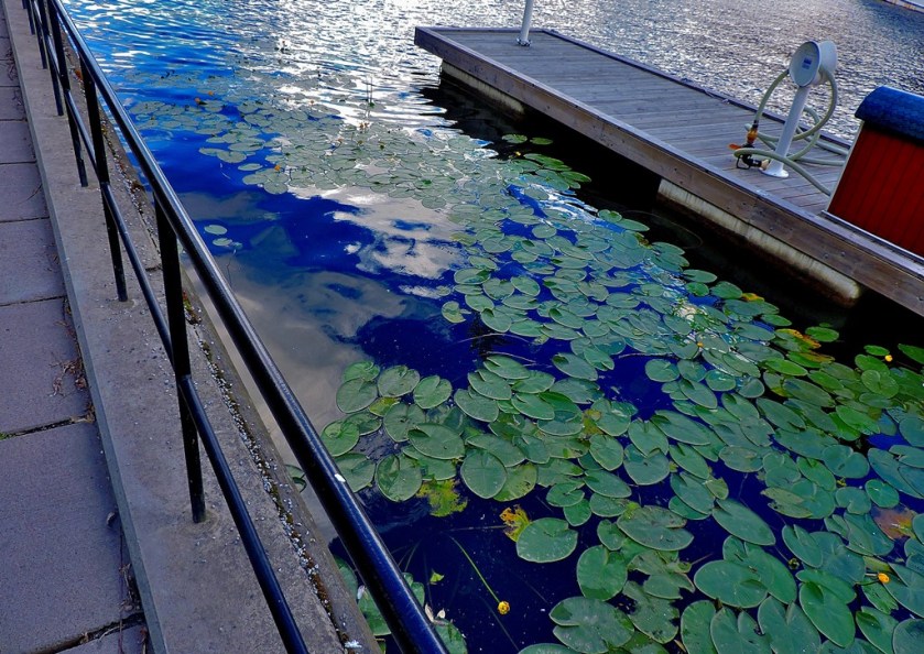
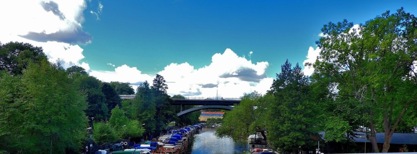
I crossed the water and was delighted to find a waterside path on the other side, which I duly set off along it.
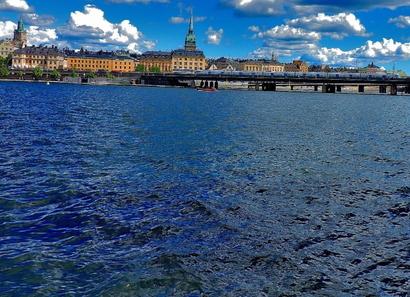
The bridge in the distance became my target – I envisaged crossing it and heading back along the other side.
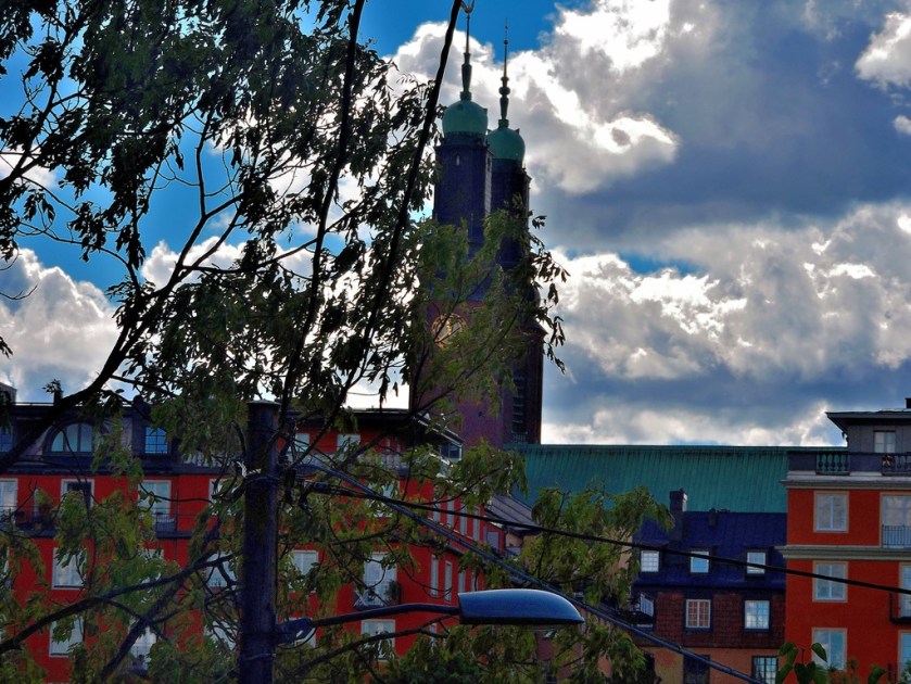
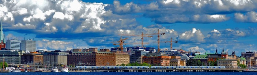
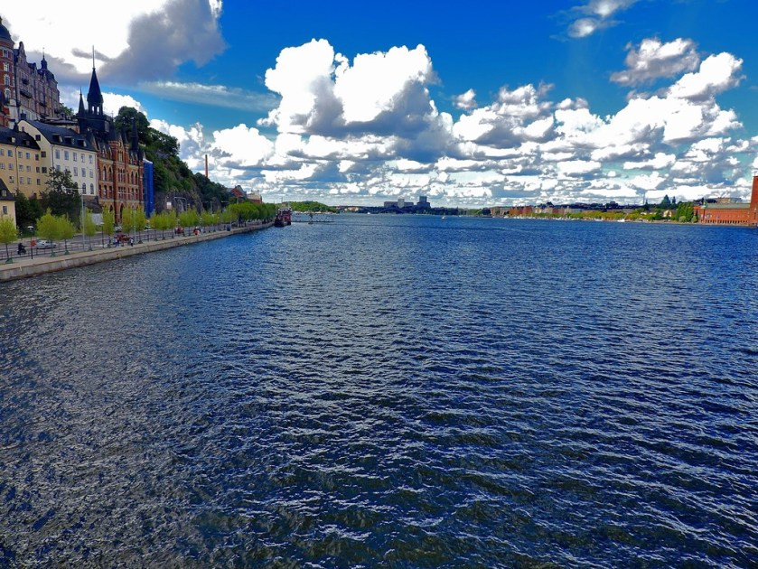
Another facet of Stockholm well shown up during this walk is how many cliffs there are.
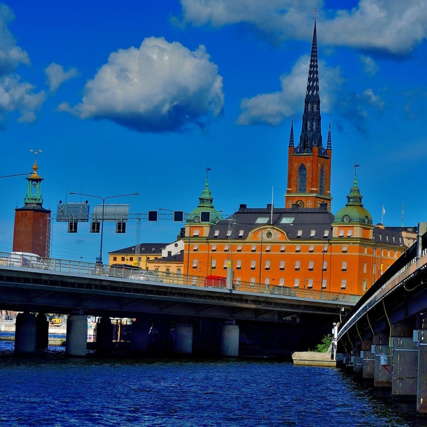
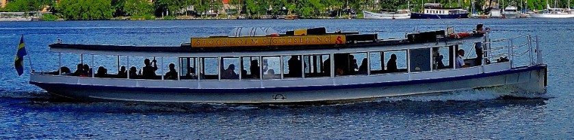
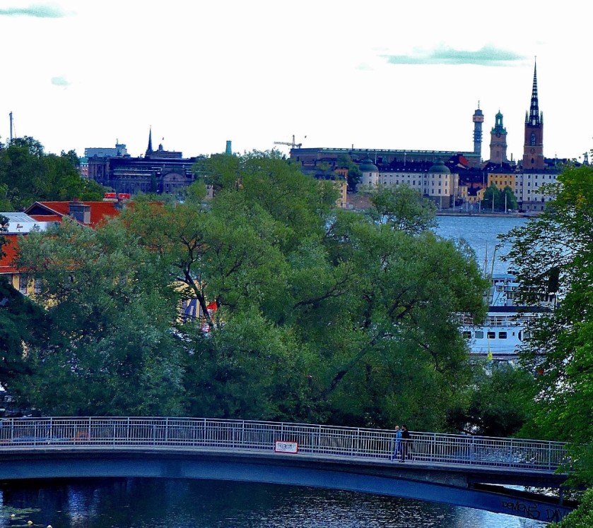
Approaching the bridge that I had marked out as my first target I found the water narrowing…
As you will see from the next set of pictures the view from the bridge gave me reason to believe that I could fulfill my plan of walking back along the other side of the water.
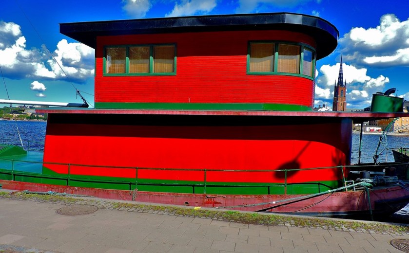
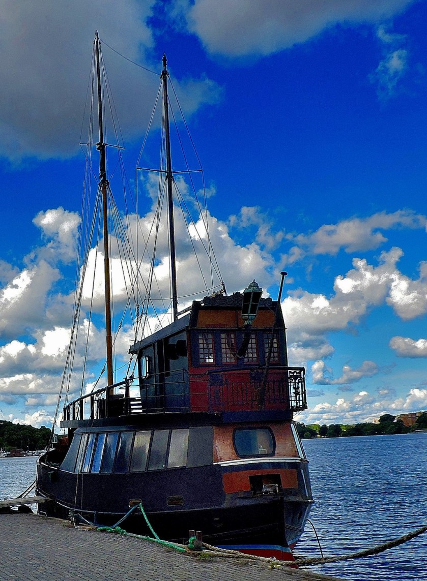
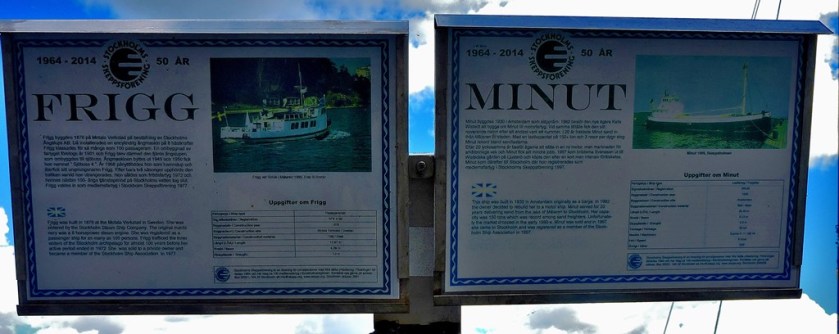
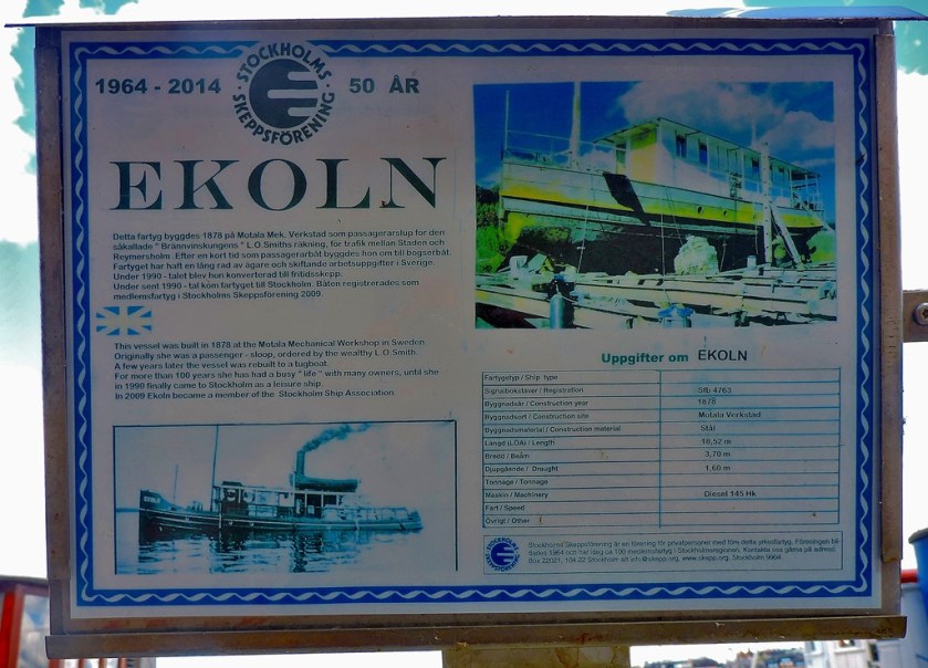
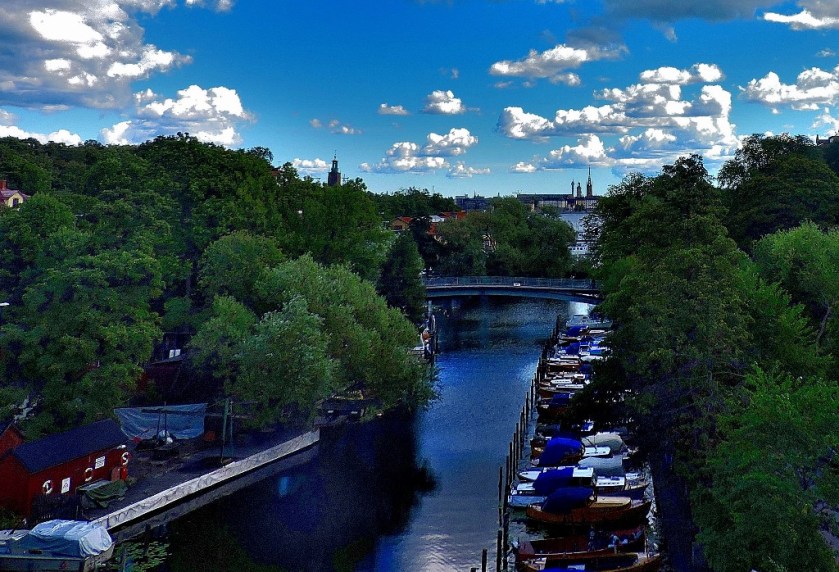
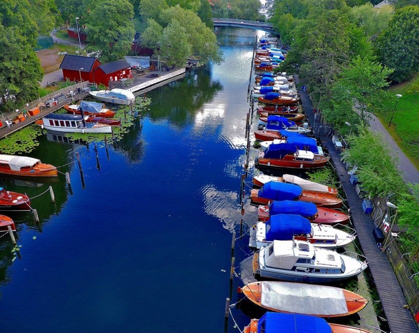
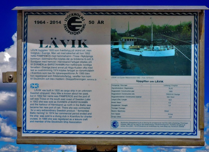
Although I located this path without difficulty it soon swung away from the water, and not long after that it became plain that the only waterside route was the one I had already taken, so I crossed a small pedestrian bridge to head back along that path. I paid close attention to the boats this time round, rather than picturing just a few…
I crossed one last bridge and headed back to Gamla Stan station to resume my travels, having thoroughly enjoyed my exploration of the heart of Stockholm.